
 |
| White's Ferry convenience store. Note the river in the distance and down a very steep hill, and the second story windows. |
 |
| Potomac flood level marks on second level. |
We continued to shake, rattle and roll all day, on the trail.

We had to walk around 5 piles of clay and rock that were soon to be spread across the trail.
 |
| The beautiful Potomac. |

 |
| The canal continues on the left and the Potomac on the right, with the towpath in the middle. |
 |
| Seneca Creek Aqueduct |

 |
| Not the kind of fishing clothes we wear today. |
If walls could talk, Lockhouse 22 could tell some tales. President Glover Cleveland, pictured above, sought refuge from the pressures of the White House by coming here on fishing trips. One lockkeeper had too much to drink and let the water out of the lock too quickly, sinking a canal boat and its 113 tons of coal.Lockkeepers and their wives supplemented their income by selling fresh baked goods and farm produce to the canal boatmen. Since there was no plumbing in lockhouses in 1880, water was carried from the canal and heated on the stove for washing clothes and dishes. Making sure the children didn't fall into the canal was a constant concern of the lockkeeper's wife, who frequently helped her husband operate the locks.


Lock gates.
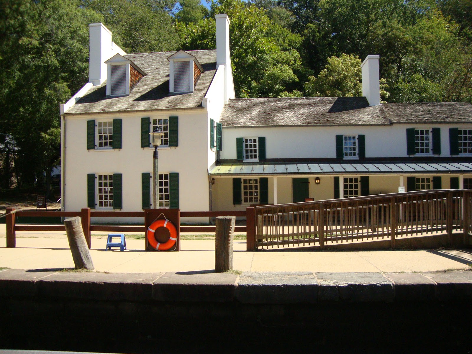
The Great Falls Tavern began as a small lockhouse and was added onto twice. The area around the tavern bustled with a community of over 100 people, including a post office.
.
Great Falls, MD has the largest falls of any river on the Eastern seaboard.


The Potomac was wide, flat, and slow moving about 2 million years ago. Then came the Ice Age. Sea level fell forcing the Potomac to carve a deeper channel to reach the ocean. Because of the difficulty in cutting through bedrock, the Potomac created waterfalls and rapids. The most dramatic drop occurs here at Great Falls. The Potomac River drops some 60 feet. In a series of rapids, it falls an additional 85 feet to tidewater at Washington, D.C., 10 miles downstream.
Great Falls, also, has the largest praying mantis. We have never seen one so big.
Definitely much bigger than our hummingbirds.


Mile marker 0! WE DID IT! This is awesome!
We are sooooo proud of ourselves!


We bicycled a total of 361 miles!
Now we will spend the next 3 days touring our wonderful Capital of the United States of America - Washington, D.C.
For the remainder of our visit, our home base will be on the military base at Ft. Myer, VA, which is just across the Potomac River from Washington, D.C. Our accommodations are wonderful! It is a small apartment.
We will have 3 more postings to this blog, as we tour Washington, D.C.
Seeing the flood markings on the Convenience Store brought back memories -- we were in Woodbridge, VA, for the flood of 72. I'm glad to see it was the highest one because it was definitely a big deal to us at the time.
ReplyDeleteLooks like you had a great time, Harold. Thanks for the blog!
ReplyDelete